
News

Harvey Miller Elected to American Association of Geographers New Fellows
Dr. Harvey J. Miller, Bob and Mary Reusche Chair in Geographic Information Science, Professor of Geography, and Director of the Center for Urban and Regional Analysis at The Ohio State University,…
Harvey Miller appointed to Mid-Ohio Regional Regional Planning Commission Regional Data Advisory Committee
CURA Director, Harvey Miller has been appointed to the Mid-Ohio Regional Regional Planning Commission (MORPC) Regional Data Advisory Committee. MORPC is Central Ohio’s regional planning council…

Mapping Science Committee and Geographical Sciences Committee Joint Fall Meeting on Accelerating the Analysis of Geographic Change
In December, CURA's Director Harvey Miller organized a joint meeting of the National Academies of Sciences, Engineering, and Medicine Mapping Science Committee and Geographical Sciences Committee…

Scooters, Ubers, and Automobiles: Sustainable Transportation with Prof. Harvey Miller
A new podcast episode with Prognosis Ohio was released this week featuring CURA Director, Harvey Miller. This episode went into sustainable transportation topics including, walking, accessibility,…

Outreach Recap: Supply-Side Headwinds for Home Building with Robert Dietz
On November 15, 2021, CURA and MORPC welcomed Robert Dietz, chief economist for the National Association of Home Builders for a webinar. Robert was the first CURA graduate associate while…
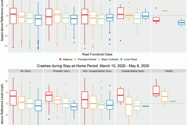
Lower Volumes, Higher Speeds: Changes to Crash Type, Timing, and Severity on Urban Roads from COVID-19 Stay-at-Home Policies
A new article co-authored by CURA's Director Harvey Miller and former CURA Graduate Research Associate Jinhyung Lee has been published in the journal Transportation Research Record.…
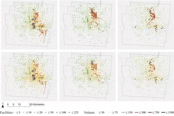
What Is Essential Travel? Socioeconomic Differences in Travel Demand in Columbus, Ohio, during the COVID-19 Lockdown
This week, an article was published in the journal Annals of the American Association of Geographers co-authored by CURA Director Harvey Miller. This study focused on the…

New Staff
In September, CURA welcomed Gerika Logan as the new Outreach Coordinator.
As the CURA Outreach Coordinator, Gerika connects researchers, students,…

Transitions
CURA's Outreach Coordinator, Katie Phillips, recently accepted a new position and will serve her last day at CURA on Friday April 30th. She is still in the OSU family and will be…