
News
Does real-time transit information reduce waiting time? Probably not
By: Luyu Liu, Harvey J. Miller
Background
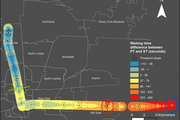
A common belief about real-time information (RTI) is the reduction of waiting time by allowing passengers…

3C GIS Day - November 18th, 2020
November 18, 9:00am – 4:00pm
GIS Day is an annual event for students, staff, faculty, and the broader community to learn more about Geographic Information Systems (GIS)…
Save the Date: GIS Day 2020
GIS Day is an annual event for students, staff, faculty, and the broader community to learn more about Geographic Information Systems (GIS) and to celebrate the power of geospatial analysis and…
Robust accessibility: Measuring accessibility based on travelers' heterogeneous strategies for managing travel time uncertainty
Robust accessibility: Measuring accessibility based on travelers' heterogeneous strategies for managing travel time uncertainty
Authors: Jinhyung Lee and Harvey…
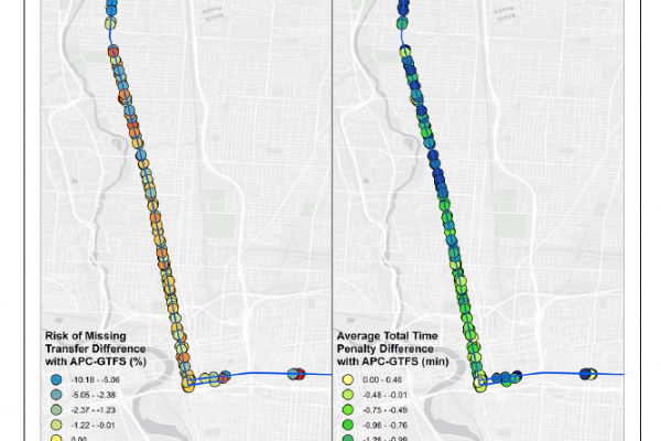
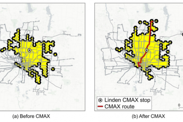
Measuring risk of missing transfers in public transit systems using high-resolution schedule and real-time bus location data
Measuring risk of missing transfers in public transit systems using high-resolution schedule and real-time bus location data
Authors: Luyu Liu and Harvey Miller

ArcGIS Online Challenge (Learning Path)
ArcGIS Online Challenge June 1 - June 30
Have you come across an interactive map on the web and wondered “how did they make that?” Have you heard about GIS (geographic information systems) and…
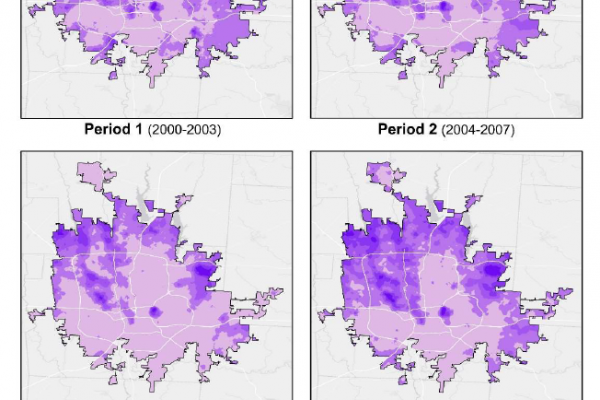
Evidence of housing price and neighborhood polarization in Columbus, Ohio
Jinhyung Lee, Nicholas Irwin, Elena Irwin, and Harvey J.
Miller
Center for Urban and Regional Analysis
The Ohio State University
15 May 2020

Evidence of Increased Vehicle Speeding in Ohio's Major Cities during the Coronavirus Pandemic
Jinhyung Lee, Adam Porr and Harvey J. Miller
Center for Urban and Regional Analysis
The Ohio State…

Using ArcGIS StoryMaps in Your Research and Teaching Workshop
The “Using ArcGIS StoryMaps in Your Research and Teaching” workshop has been transformed to be offered as an asynchronous online exercise that you can complete at your own pace. All of…