News

Westfest 2019
Earlier this month CURA had to opportunity to participate in Westfest 2019, held on the West Campus of the Ohio State University.
Westfest is an annual, free public event showcasing…
Researchers Represent CURA at the 2019 AAG Conference
CURA was well-represented at the 2019 American Association of Geographers annual meeting, which took place in Washington DC in early April.
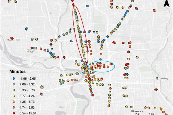
Transfer RiskGraduate research associate Luyu…

Recap Workshop: Web Mapping Basics with ArcGIS Online
Last month our Outreach Coordinator, Katie Phillips and Geospatial Information Librarian, Josh Sadvari co-presented a workshop on the basics of web mapping using ArcGIS Online (AGOL). This…
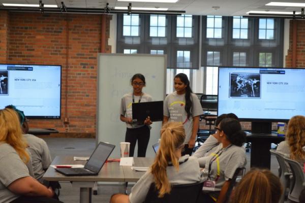
Outreach Recap: Big Data for Good
The paint may still be drying at recently-renovated Pomerene Hall, but that didn’t deter 28 intrepid high-school age women from participating in the Women in Data Science Summer Camp hosted by the…
Researchers represent CURA at 2018 AAG Conference
CURA was well-represented at the 2018 American Association of Geographers annual meeting, which took place in New Orleans in April.
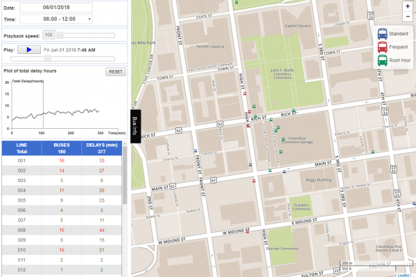
Bus DelaysPost-doctoral researcher Yongha Park presented…
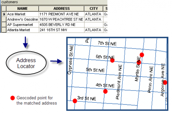
Featured resource: CURA Geocoder
Did you know that CURA maintains a free geocoding service for use by OSU students, faculty, and staff? Read this post to learn how you can use the CURA geocoder for your next project.
In…
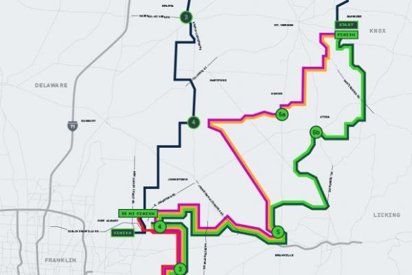
CURA helps Pelotonia create route map
Pelotonia, a nationwide fund raising campaign to fight cancer, attracts thousands of bikers every year. CURA played an active role in making route maps for the 2014 Pelotonia.
http:/…
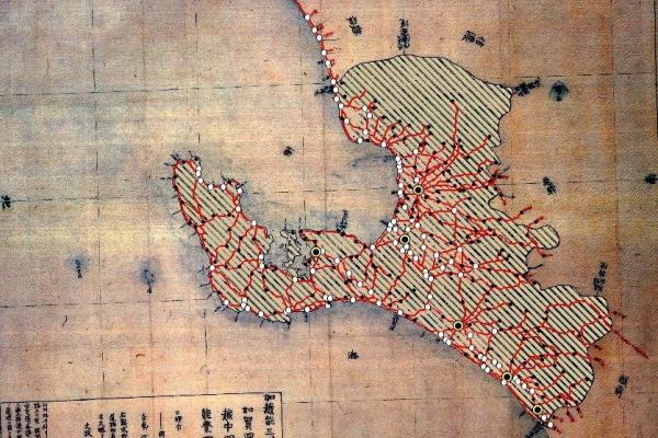
Reproducing 19th Century Japan with GIS
CURA's Dr. Peter Chen partnered with Professor Philip Brown in the Department of History to digitize a 19th century Japanese map. This map will be used for Professor Brown's research project…